Since I can’t go to the field right now, I am stuck with analyzing the amazing LiDAR data from Slovenia. We have 1 m resolution data covering the entire country and oh my god it’s great for active tectonics research. But how do you actually make a DEM from the data? Here’s a quick guide using free software only.
Download the data
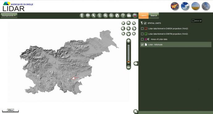
First, visit the ARSO website that hosts the data: http://gis.arso.gov.si/evode/profile.aspx?id=atlas_voda_Lidar@Arso&culture=en-US. Now zoom into your area of interest (I decided to go for a stretch of the Žužemberk Fault, see arrow) and activate the D48GK grid.
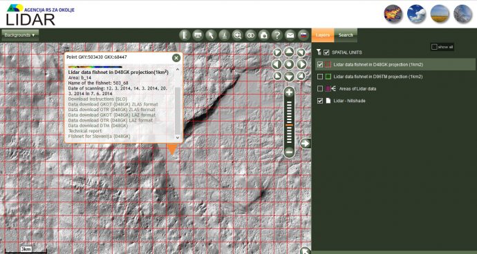
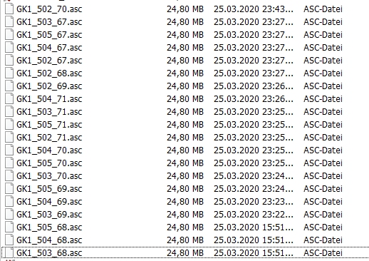
If you now click on one of the tiles you see several download options. Let’s download the DTM which comes in ASC format. I downloaded a rectangle of 5×4 tiles for our purpose, each 24.8 MB.
Make the DEM
Unfortunately, you can’t simply throw the tiles into QGIS, so let’s use a great piece of free software instead – CloudCompare. This is such a powerful tool when it comes to working with point clouds, you should check out all its capabilities at some point. Here’s the download website: https://www.danielgm.net/cc/. Install and run it. Now drag & drop the 20 tiles into CloudCompare:
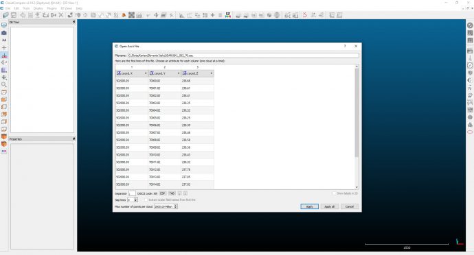
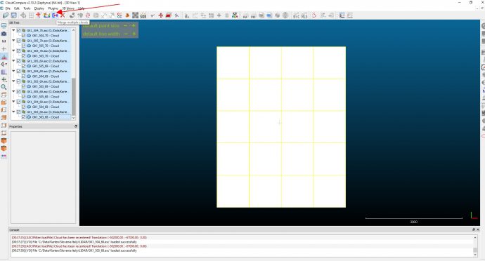
Click “Apply all” and then “Yes to all” and you should quickly see your tiles. Select all tiles in the DB tree and click “merge multiple clouds”:
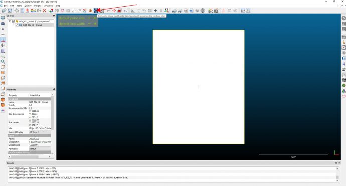
Click “no” when asked if you want to create a scalar field with the original cloud index. Now you actually have a point cloud that you can tilt, zoom into, colour by elevation etc. However, we want just a DEM. When the merging is done, click “convert a cloud to 2D raster”:
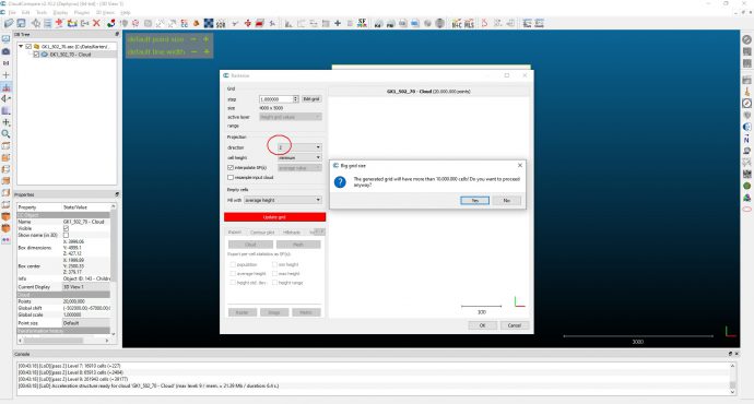
Choose “Z” as the projection plane because we want a DEM and not a side view, then click “update grid” and “yes” in the dialogue.
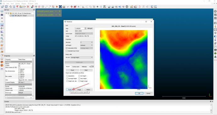
Now the DEM is ready. You can export it by simply clicking on “raster”:
Check the results
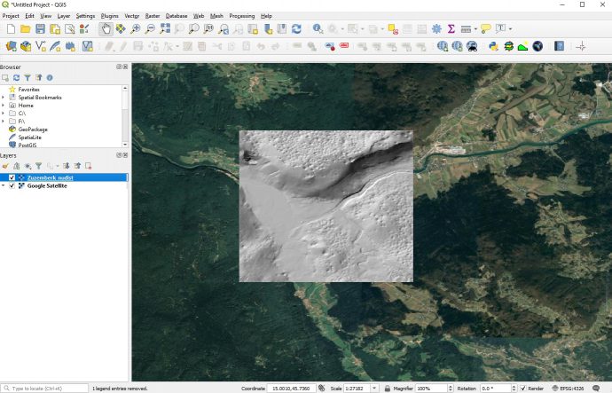
That’s it, your raster file is saved in the same folder as the original tiles. Let’s check if it worked. Open QGIS (https://qgis.org/en/site/) and drag & drop the new raster into the layer panel. Double click on the layer, select “Source” and choose EPSG 3912 (National Slovene Grid). I usually duplicate the layer and make the lower one a hillshade and the upper one a semi-transparent singleband pseudocolour scheme. I also load GoogleMaps satellite imagery to check if the projection is right (Menu –> Web –> QuickMapServices –> Google; make sure to check the settings of this plugin, which allow you to get more services as a contributed pack…). Yepp, looks good. The Žužemberk Fault in all its glory and surrounded by the most amazing karst morphology.
What else?
Well, downloading all the tiles for Slovenia like this is of course time-consuming. I once knew a very clever guy who wrote a small script that would allow him to download all the available tiles from the ARSO website. He then created a set of LiDAR chunks of just below 4 GB each that cover the whole country… Drop me a mail if you’re interested.


Florian | 2021-11-30|12:03 (UTC)
Hey, is it possible to have the set of Lidar chunks for the whole country?
I would be interested
Best regards
Florian, Computer Science Student
Paolo | 2021-12-03|10:26 (UTC)
I would be interested in a lidar image, Kostanjevica area -fajti thanks Paolo
Mat | 2023-01-25|15:05 (UTC)
Greetings,
great article, helped me a ton. Would it be still possible to get a script or Lidar chunks? Thank you
Josh | 2023-02-25|20:41 (UTC)
The Slovenian government site seems to be down/broken, I’d love to get the script/lidar data for the entire country if you still have it and are able to share. Thanks
Tommaso | 2023-10-03|15:33 (UTC)
Would it be still possible to get a script or Lidar chunks? Making a big project about the Country
Sebastijan | 2025-12-04|13:40 (UTC)
Hi, I know this was posted long time ago, but would be very much interested in full Lidar map.
thank you
Sebastijan