As soon as I learned that the new iPad Pro comes with a LiDAR scanner I knew I would have to check how useful it is. Luckily, Kamil was able to buy one for our group. So we (Georg and myself) tested the 11″ version on an outcrop right next to our institute and I also scanned the way back to the office. I used the app LiDAR Scanner 3D. The full version costs 0.99 € and allows you to save and export the models as USDZ, OBJ, STL, and PLY files. I used CloudCompare to check the data.
Scanning an outcrop
The outcrop shows slightly folded Röt sediments along a road cut. The interesting features should be visible in a 3D model with about 1 cm resolution, judging from layer thickness and fold wavelength. Next to the outcrop the slope is stabilized with gabions.
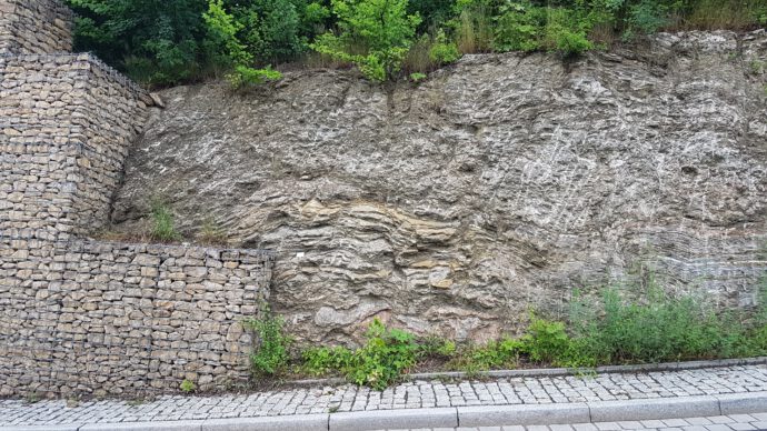
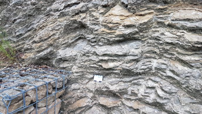
It’s incredible how quick and easy the scanning works. Just push the button and the app will indicate the already scanned areas of your target. Move the iPad around a bit to capture the full geometry without shadows, and that’s it. In a first attempt I tried to scan the outcrop from the opposite side of the road, but the range is really limited to ~5 m so I had to go closer.
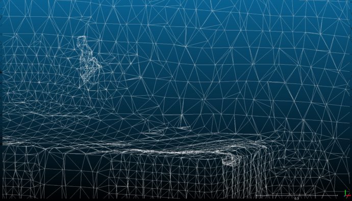
You can already see the triangulated mesh in the app during the scan, but the mesh doesn’t change if you keep on scanning the same target or if you go closer. Most triangles seem to have side lengths of ~0.1 m, some have around 0.03 m side length. I found no way of influencing the resolution of the mesh. The app is a black box without any options. No details from the outcrop are visible in the 3D model, only the geometry of the gabions can be seen. Quite disappointing. Also, the app doesn’t use the camera to take pictures of the outcrop. You don’t have any RGB information in the model.
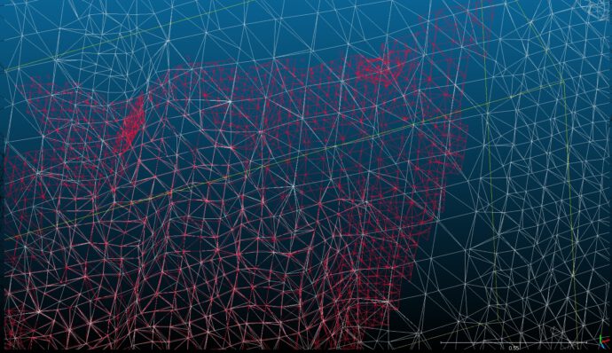
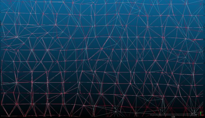
In order to test how reproducible the scan is, I scanned the same part of the outcrop twice. In the image below you see the mesh from the first run in white, the mesh from the second run in red. They are almost identical. The difference in the location of the nodes is <1 cm for most of them.
Scanning the way back to the office
Let’s have a look at the second experiment, when we scanned the way back to the office. Now this is really cool, because we weren’t interested in the details and scanning was again very quick.
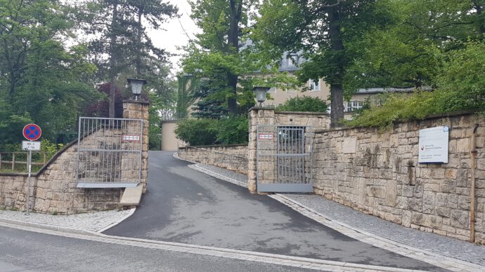
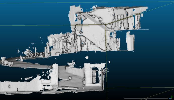
This really seems to be the strength of the LiDAR – scanning large, simple structures like a room or a hallway. You can even see me standing in front of the gate and my colleague Benjamin sitting at his desk.
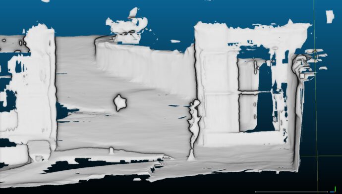
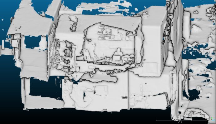
One thing that worked surprisingly well was the relative positioning of the individual scans. I imported all three models (the two scans of the outcrop and the large model from our institute) into CloudCompare and they were exactly where they should be.
Summary
Scanning the details of the outcrop failed, but it’s still a nice tool if you are interested in the larger-scale geometry of things, perhaps like a large fold or so. Remember, you need to be able to get as close as 5 m to the target. Too bad the app is a black box without any options to play with, and too bad it doesn’t give you access to the raw data, i.e. the point cloud. I hope that there will be apps coming that also incorporate the RGB information from the cameras and that allow you to customize scan resolution, point density, and so on. For now the use of the LiDAR is really limited – at least with this app – but the potential is huge. Structure-from_motion does a much better job so far.
Stéphane pointed me to this video in which an app from AboundLabs was used – this is promising! Will try it next. I will also have to check apps that run Structure-from-Motion on the fly. Which apps can you recommend?
Pros
- Very easy to use.
- Scanning is quick.
- File size is not large – 13 MB for the large model, less than 1 MB for the small models.
- Export into well-known formats is possible: USDZ, OBJ, STL, and PLY files.
- Scans are reproducible.
- App is cheap.
Cons
- No raw data (point cloud) output.
- No options that you can play with.
- Impossible to control point density.
- Resolution is too low for many geology applications.
- No RGB data.
- The iPad Pro is really expensive.


3d Scanning Service | 2021-07-23|08:52 (UTC)
Your article is such an informative article. It is glad to read such those articles. Thanks for sharing.
Modular building construction | 2021-07-24|11:27 (UTC)
Thanks for sharing this wonderful article, I really like it.
Dentist Parramatta | 2021-12-02|12:22 (UTC)
Thanks for sharing this useful piece of content 🙂