Geomorphic indices can tell us about the tectonic activity of an area. The idea is that the landscape records the signal of active tectonics, for example in its river network, in its erosion pattern, or in its roughness. Geomorphic indices allow us to quantify this, that is, we can use standard algorithms to calculate numbers from a DEM that say ‘active’ or ‘inactive’. This is very attractive because essentially, all that is needed is a DEM and a GIS (and perhaps MATLAB). The number of papers on geomorphic indices is currently exploding, and I guess the fact that the method is so cheap and easy to apply plays a major role in that. No expensive field work, still meaningful results. But is this always true? In a new open access paper, we argue that without ground checking, probably not, at least in many cases.
We used a study area in Western Slovenia. Here, the Adriatic Plate is moving north relative to Eurasia with about 3 mm/yr only. This deformation is taken up by a set of right-lateral strike-slip faults:
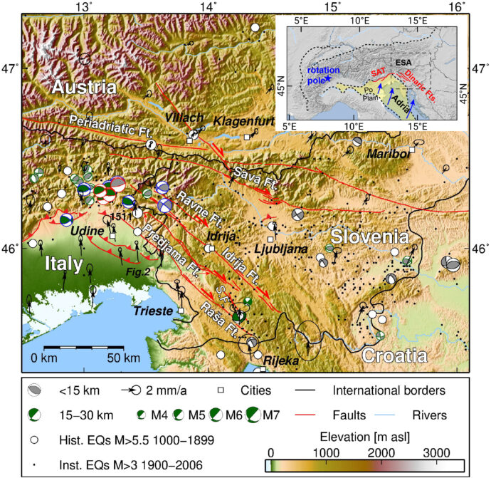
We applied many standard indices that are widely used, like ruggedness, surface roughness, hypsometric integral, and analyses of drainage parameters (knickpoints, normalised steepness index, χ-maps etc). Since the area is karstified, we also looked into doline density and doline geometry to see if they tell us about fault activity. We had a very good DEM from lidar that we downsampled to 5 m resolution. It turned out that many of the indices we used failed to identify faults that we know are active, while several inactive faults gave false positive results.
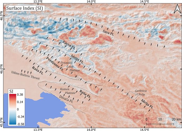
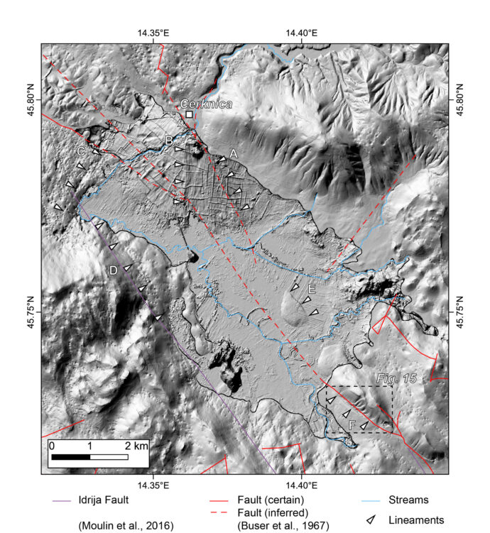
We then investigated single fault traces in more detail, but still found that several of the applied methods did not work satisfactorily. Finally, we focussed on a single karst polje located on the Idrija Fault using data with very high resolution, but with limited insights.
We use these examples to explain why the standard techniques often fail. In our case, it’s mainly karst processes that control landscape evolution and that disturb the drainage pattern. Lithological changes also lead to signals that can be confused with those of active tectonics. Since our region of interest is deforming very slowly, tectonic deformation is often outpaced by other landscape-forming processes. We argue that many studies do not take these effects properly into account, especially if they are not accompanied by field work.
Reference:
Diercks, M.-L., Grützner, C., Welte, J. & Ustaszewski, K. (2023). Challenges and Limits of Remote Sensing of Active Tectonics in the Slowly Deforming Karst Landscape of W Slovenia and NE Italy. Geomorphology 440, 108894. https://doi.org/10.1016/j.geomorph.2023.108894


Eduardo Salamuni | 2023-09-18|13:36 (UTC)
I completely agree with Prof Grützner’s analysis. In order to obtain reliable data and results regarding morphotectonics, fieldwork is essential; the search for climatic effects on morphology (erosion, for example); and a broad knowledge of structural features generated by ancient tectonic regimes.
Furthermore, the use of geophysics is one of the tools that need to be considered in the process of understanding tectonic geomorphology.
Carlos Costa | 2025-10-14|16:17 (UTC)
Congrats for contributing with this interesting and necessary paper Christoph. I agree with the conclusions and with the previous comments. Current literature is being flooded with data on morphometric indexes, raising clear that many conclusions come out without necessarily considering alternative hypotese.
As it is stated, the use of indexes is quite tempting, but we should be aware that contrasting the differences between active vs. passive control of structures on landforms requires ground check, which sometimes could also remain unconclusive (which is valid not only for slowly deforming regions.