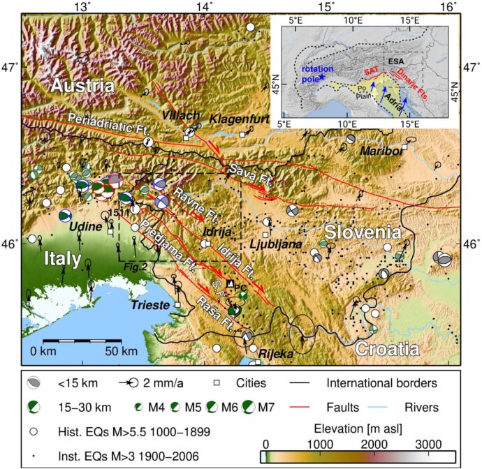
Western Slovenia hosts well-known active strike-slip faults, which accommodate the northward motion of the Adriatic Plate. So far, very little was known about large earthquakes on those faults. This is mainly due to the low slip rates. In a new paper we present geomorphological, geophysical, and paleoseismological data from the Idrija and Predjama Faults, which are among the longest faults in the area. We show that tectonic geomorphology and paleoseismology are really complicated in this kind of geological setting, but we also present data that indicate strong earthquakes during the Holocene. Here’s a short summary of what we did and what we found:

Predjama Fault
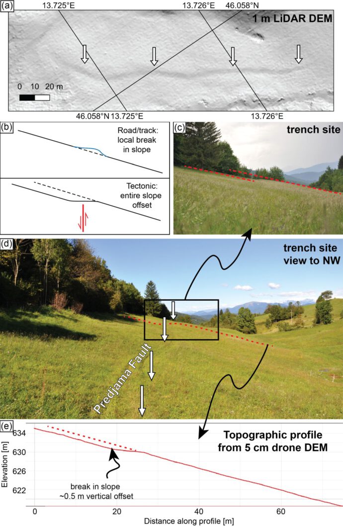
From outcrop observations we knew that the right-lateral Predjama Fault forms an up to 30 m wide fault zone. However, we managed to identify a site with a pronounced break in slope forming an uphill-facing scarp. First we were unsure if the break in slope could have been simply due to a little track used by the local farmers, but closer inspection showed that the entire slope is systematically offset be about 0.5 m (also see Copley et al., 2018).
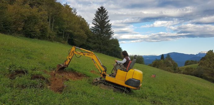
We then surveyed the area with geophysical techniques: georadar (GPR), geoelectrics (ERT), and magnetics. There were a couple of reasons for that: First, we wanted to make sure that there actually is a fault; second, we wanted to find the perfect trench site; and third, we needed to make sure that there were no ammunition or duds in the subsurface, because the area was heavily affected by the 12th Battle of the Isonzo in 1917. I won’t take any chances when it comes to excavating a trench… The geophysics results were promising and we started digging.
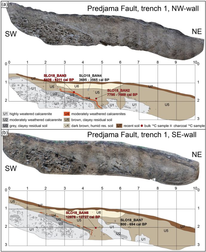
We found deformed units right below the break in slope and where the ERT data indicated the location of the fault. The deformation patterns combined with radiocarbon dating results can be explained by at least one strong earthquake that occurred on the fault in the past 13-0.7 ka, probably after 8.4 ka. However, there is also the possibility of shallow-seated mass movements or soil creep. Pedogenic development above the weathered bedrock units could have contributed to the apparent deformation, perhaps aided by oblique run-off processes. However, there is no geomorphological observation that would support this view.
Idrija Fault
At the Idrija Fault we found no morphological expression of a recent surface-breaking event. That’s why we concentrated on a small basin with young fluvial deposits that lies on the mapped fault trace.
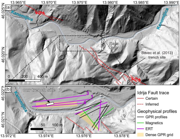
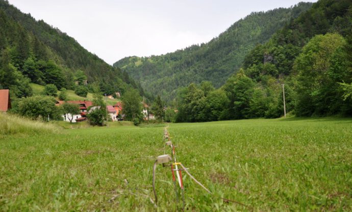
Again, the ERT data proved very useful and showed us a clear resistivity contrast in the subsurface that lined up with the mapped fault trace. We started digging again…
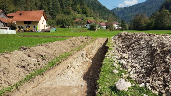
… and found a sequence of coarse fluvial deposits and fine grained material in a channel. Within the channel deposits we encountered vertically terminated layers and a fissure filled with overlying material. Beneath the channel there were vertically aligned pebbles and the one and only fractured clast in the entire trench. Again, the location of these deformation features fit perfectly with the anomaly that we could see in the ERT data down to a depth of about 30 m.
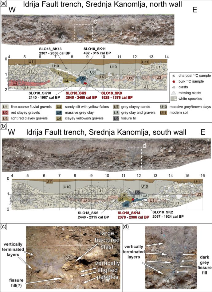
Our radiocarbon results indicate that a strong quake occurred on the fault most likely between 2645–2306 cal BP. We did not find evidence for the famous 1511 Idrija Earthquake that destroyed the nearby mercury mining town of Idrija. So there are still some puzzles to solve – which fault caused the 1511 event? Was this a blind rupture? Bavec et al. (2013) claim to have found the 1511 earthquake in a trench just across the hill from ours. Falcucci et al. (2018) report the 1511 event to show up in a trench on the mountain front that borders the Friulian Plain to the east…
Conclusions
Our combination of geomorphological investigations, near-surface geophysical surveys, and paleoseismological trenching was successful. We can show that surface-rupturing earthquakes happened on the Predjama and Idrija faults in the Holocene. These faults are capable of strong earthquakes, which likely dominate the overall seismic moment release on the NW–SE-trending strike-slip faults in the study area. The earthquakes that we found were likely stronger than those on record.
Acknowledgements
Thanks to our wonderful field crew: Alexander Krämer, Andrea Viscolani, Hamid Sana, and Wahid Abbas. We had great discussions with Jure Atanackov, Jernej Jež, and Tomaž Fabec. Also many thanks to the hospitable landowners for supporting our science! This study was undertaken in the framework of SPP 2017 – Mountain Building Processes in 4D. Our research has been supported by the Deutsche Forschungsgemeinschaft (grant nos. GR 4371/1-1 and GR 4371/3-1) and the Javna Agencija za Raziskovalno Dejavnost RS (grant no. P1–0011).
Additional open access data
- The full geophysics dataset: https://doi.pangaea.de/10.1594/PANGAEA.922902
- A drone DEM from the Predjama Fault: https://portal.opentopography.org/dataspace/dataset?opentopoID=OTDS.032021.4326.2
- A drone DEM from the Idrija Fault: https://portal.opentopography.org/dataspace/dataset?opentopoID=OTDS.032021.4326.1
References and further reading
- Bavec, M., Car, M., Stopar, R., Jamšek, P., & Gosar, A. (2012). Geophysical evidence of recent activity of the Idrija fault, Kanomlja, NW Slovenia. Materials and geoenvironment, 59, 247-256.
- Bavec, M., Atanackov, J., Celarc, B., Hajdas, I., Jamšek Rupnik, P., Jež, J., Kastelic, V., Milaniˇc, B., Novak, M., Skaberne, G., & Žibret, G. (2013). Evidence of Idrija fault seismogenic activity during the Late Holocene including the 1511 Mm 6.8 Earthquake, in: Proceedings of the 4th International INQUA Meeting on Paleoseismology, edited by: Grützner, C., Rudersdorf, A., Pérez-López, R., and Reicherter, K., Active Tectonics and Archeoseismology (PATA), 9–14 October 2013, Aachen, 23–26, ISBN 978-3-00-042796-1.
- Copley, A., Grützner, C., Howell, A., Jackson, J., Penney, C., & Wimpenny, S. (2018). Unexpected earthquake hazard revealed by Holocene rupture on the Kenchreai Fault (central Greece): Implications for weak sub-fault shear zones. Earth and Planetary Science Letters, 486, 141-154.
- Falcucci, E., Poli, M. E., Galadini, F., Scardia, G., Paiero, G., & Zanferrari, A. (2018). First evidence of active transpressive surface faulting at the front of the eastern Southern Alps, northeastern Italy: insight on the 1511 earthquake seismotectonics. Solid Earth, 9(4), 911-922.
- Grützner, C., Aschenbrenner, S., Jamšek Rupnik, P., Reicherter, K., Saifelislam, N., Vičič, B., Vrabec, M., Welte, J., & Ustaszewski, K. (2021): Holocene surface-rupturing earthquakes on the Dinaric Fault System, western Slovenia. Solid Earth, 12, 2211–2234, https://doi.org/10.5194/se-12-2211-2021.
- Moulin, A., Benedetti, L., Gosar, A., Rupnik, P. J., Rizza, M., Bourlès, D., & Ritz, J. F. (2014). Determining the present-day kinematics of the Idrija fault (Slovenia) from airborne LiDAR topography. Tectonophysics, 628, 188-205.
- Moulin, A., Benedetti, L., Rizza, M., Jamšek Rupnik, P., Gosar, A., Bourles, D., … & Ritz, J. F. (2016). The Dinaric fault system: Large‐scale structure, rates of slip, and Plio‐Pleistocene evolution of the transpressive northeastern boundary of the Adria microplate. Tectonics, 35(10), 2258-2292.


No Comments
No comments yet.