Update: Read the article of The Times of Oman here!
Today at 11:52:50 UTC a magnitude 6.3 earthquake occurred in SW Iran close to the shore in a depth of 10 km. The event was widely felt in Iran and across the NE Arabian Peninsula. Moment tensor solution reveal a thrust mechanism, which is in perfect concordance with the historic seismicity pattern. The event was caused by the convergence of the Arabian and Eurasian plates, that not only built up the impressive Zagros Mountains, but also lead to the formation of the Makran Subduction Zone. Relative plate motions there are as fast as 20 mm/yr in the central part.
I am currently in Mascat, Oman, and I can confirm that the earthquake wasn’t felt here. (As always, I am in the “wrong” location from an earthquake researcher’s point of view…) EMSC provides a nice overview of the felt reports:
The moment tensor solutions can be found at the same website:
Historical seismicity shows that even strong earthquakes in that area are quite common:
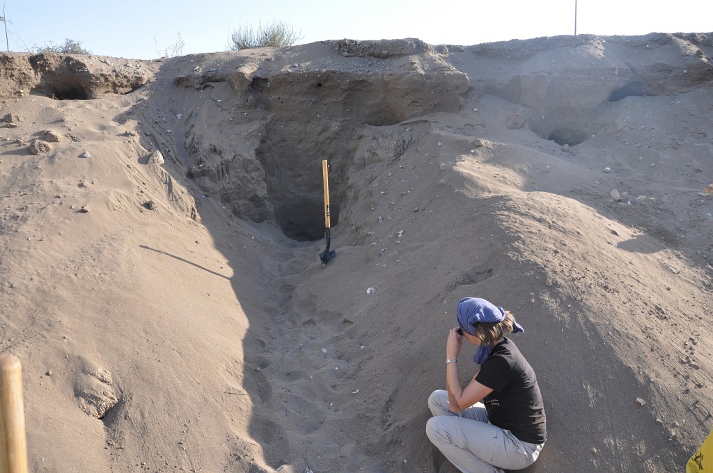
This continent collision zone is suitable of producing far stronger events, which also poses a certain threat to Northern Oman’s Musandam area. See El Hussein et al., 2012 for seismic hazard maps of Oman. Smith et al., 2013, recently published modelling studies on the Makran Subduction Zone and concluded on possible Mw9.2 events. These events are the most likely cause of paleotsunamis that have been reported in recent studies by Hoffmann et al., 2013. I am still doing research on that here in Oman, and just today my colleagues Gösta Hoffmann, Magda Rupprechter from GUtech and me opened a trench near Muscat to check a suspect shell layer in a coastal-near outcrop for its tsunami origin:
As I’ve written in my last post, we are also conducting field studies for finding out if there are active faults in Oman itself. The last earthquake that has been felt in Muscat occurred in 1945. This event was a large event (>M8.0) that happened offshore at the Makran Subduction Zone and this event also caused a tsunami that reached the Omani coast…
References:
- I. El-Hussain, A. Deif, K. Al-Jabri, N. Toksoz, S. El-Hady, S. Al-Hashmi, K. Al-Toubi, Y. Al-Shijbi, M. Al-Saifi, and S. Kuleli, 2012. Probabilistic seismic hazard maps for the sultanate of Oman. Nat Hazards, 64, 1, 173-210, DOI:10.1007/s11069-012-0232-3.
- G. L. Smith, L. C. McNeill, K. Wang, J. He, and T. J. Henstock, 2013. Thermal structure and megathrust seismogenic potential of the Makran subduction zone. Geophysical Research Letters, doi: 10.1002/grl.50374.
- G. Hoffmann, K. Reicherter, T. Wiatr, C. Grützner, and T. Rausch, 2013. Block and boulder accumulations along the coastline between Fins and Sur (Sultanate of Oman): tsunamigenic remains? Natural Hazards, 65, 851–873, DOI:10.1007/s11069-012-0399-7.


No Comments
No comments yet.