During December, Greece has suffered from heavy rains and severe flooding. The following video shows a church near the town of Schinos (Skinos), which has been seriously affected by flooding and sedimentation. Many geology students and many paleoseismologists will find the church looking familiar, and I will explain why:
The church
Let’s start with the story of the church. The church can be found at the northern coast of the Perachora peninsula:
The setting
Here, mountains of more than 800 m height are located right at the shore. They are made up of limestones and some ophiolites occur at the top. Especially the ophiolites are subject to intense erosion and due to the steep slope angles, the material can easily be mobilized.
A large alluvial channel developed, up to 100 m wide, and forms a nice fan delta in the sea. The active channel is currently located in the eastern part of the valley. The church was unfortunately built directly into the alluvial fan (Bambakies Fan). During the heavy rains, the gravels were mobilized and almost buried the church entirely. Here’s an image from the lowest part of the fan:

Lowest part of the Bambakies Fan, the wall in the right already belongs to the church. (Image from Panoramio)
It’s kind of obvious why this could be a rather bad building site. In this case, the church was not build on the fan surface, but a several meter deep pit was excavated for the foundations so that a more than 5 m high vertical wall of gravel was right behind the building, see image above.
The optimist’s house
The church wasn’t the only building in this hazardous setting. A few meters upstream the gully a new house was built few years ago. Due to its position right on the fan (in the gully) it was called “The Optimist’s house” by some geologists (actually, they found some more harsh words).

A closer look to the scene, with the locations of the church, the Optimist’s house and the paleoseismological trenches of Pantosti et al. Image from GoogleEarth.
The owner of this house accidentally chose an even worse place for building, and this is why the site might have appeared familiar to you: It’s right on the fault trace of the Schinos fault (Skinos fault), and in between a set of paleoseismological trenches opened by Daniela Pantosti and colleagues for finding surface ruptures of the 1981 earthquake series.
The 1981 earthquakes and the trenches
In 1981, a series of strong quakes rattled the eastern Gulf of Corinth/Corinth-Alkyonides Gulf area and three events had magnitudes greater M6 (Jackson et al., 1982). The surface ruptures of one of these events were identified in the Schinos trenches. Pantosti et al. (1996) measured an average offset of 0.6-0.7 m here. The fan has a cumulative Holocene displacement of about 5 m. They calculated a earthquake recurrence intervall of 700 years for the Schinos (Skinos) fault. The impressive morphology testifies to the tectonic activity of this area, too.
I always go there with my students when I am on excursion in the area, because the seismic landscape is amazing and there are not many trenches in Greece (yet). Also, it is a great spot to discuss whether the offset in the trenches are real coseismic offsets or maybe relate to a large, seismically triggered slide.
In 2011 the trenches were visited by the participants of the 2nd INQUA meeting that took place in Corinth. (By the way, you can download the Corinth2011 abstracts volume with dozens of reviewed extended abstracts (short papers up to 4 pages) for free here (PDF, 150 mb): http://ees.kuleuven.be/igcp567/images/Corinth2011-abstractvolume.pdf.)
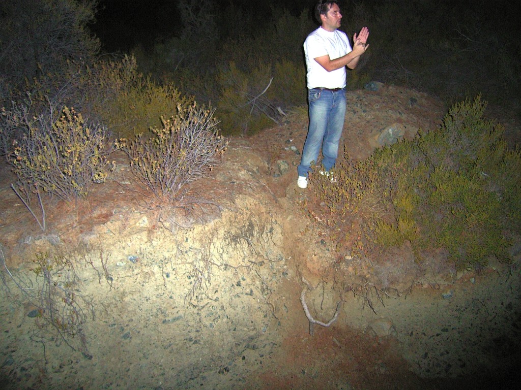
Daniela Pantosti lead the excursion in this area and dozens of paleoseismologists climbed the alluvial fan and disappeared in the bushes immediately in order to find surface ruptures, coseismic offsets, trenches and to take hundreds of pictures:

Geologists disappearing in the bushes. A cumulative scarp developed during the last few thousands of years. Most people stand on the hanging wall, few on the footwall.
Video from the Corinth 2011 workshop, the excursion to the trenches starts at 6:24.
So the optimist selected a rather delicate site for his house: there’s a serious flooding hazard, there is a certain mass movement hazard, and it’s built on the trace of a surface rupturing fault, which might be activated by any nearby major event. At least the house might not be affected by the next wildfire.
I am not sure if the church will be emptied and restored. I think it should be kept as a memorial, reminding people of how important geology is to their everyday life.
References
- Grützner, C., Pérez-López, R., Fernandez Steeger, T., Papanikolaou, I., Reicherter, K., Silva, P.G. and Vött, A. (Eds.) 2011. Earthquake Geology and Archaeology: Science, Society and Critical Facilities. Proceedings of the 2nd INQUA meeting on Active Tectonics, Earthquake Geology, Archaeology and Engineering in Corinth, Greece, 2011.
- Jackson, J.A., Gagnepain, J., Houseman, G., King, G.C.P., Papadimitriou, P., Soufleris, C., and Virieux, J. 1982. Seismicity, normal faulting, and the geomorphological development of the Gulf of Corinth (Greece): the Corinth earthquakes of February and March 1981. Earth and Planetary Science Letters, 57-2, 377–397.
- Pantosti, D., Collier, R., D’Addezio, G., Masana, E., and Sakellariou, D. 1996. Direct geological evidence for prior earthquakes on the 1981 Corinth fault (central Greece). Geophysical Research Letters 23-25, 3795-3798.


No Comments
No comments yet.