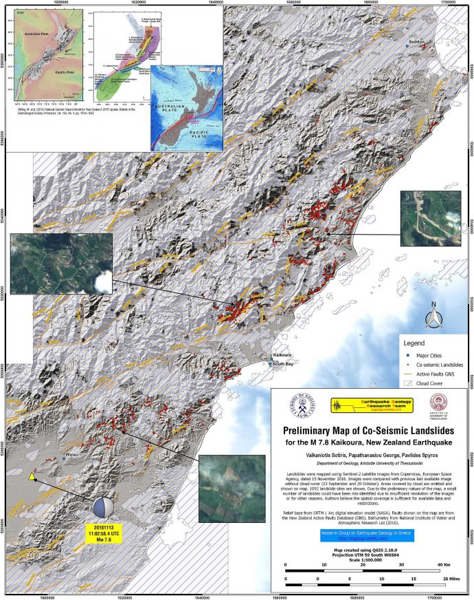
The M7.8 Kaikoura Earthquake in New Zealand produced one of the most complex ruptures ever observed, involving many different faults. Earthquake environmental effects include up to 10 m offset at the Kekerengu Fault, secondary ruptures, a tsunami, coseismic uplift, landslides and rockfalls, liquefaction, and maybe even earthquake lights. Lots of blogs and websites provide coverage on this earthquake, e.g. Geonet, the Landslide Blog, and The Trembling Earth. Our colleagues from the Research Group on Earthquake Geology in Greece worked on the landslides that happened during the earthquake. George Papathanassiou sent me the link to their Preliminary Map of Co-Seismic Landslides for the M 7.8 Kaikoura, New Zealand Earthquake.
They used Sentinel-2 satellite images to map more than 1000 large landslides.

Landslide map by the Research Group on Earthquake Geology in Greece
The map is available in A2 as JPG, PDF, and KMZ overlay.
Please cite the map as:
- Valkaniotis Sotiris, Papathanassiou George, & Pavlides Spyros. (2016). Preliminary Map of Co-Seismic Landslides for the M 7.8 Kaikoura, New Zealand Earthquake [Data set]. Zenodo. http://doi.org/10.5281/zenodo.167130


No Comments
No comments yet.