A few weeks ago I spent ten days of field work in the Suusamyr Valley in Kyrgyzstan. In the framework of the EwF Project and COMET a team from Oxford (Eleanor Ainscoe, Austin Elliott, Richard Walker) and Kyrgyzstan (Kanatbek Abdrakhmatov, Azat Moldobaev) re-visited the epicentral area of the 1992 MS7.3 Suusamyr earthquake. This thrust earthquake is quite special for it produced intense and widespread secondary earthquake environmental effects (landslides, rockfalls, secondary ruptures, mud eruptions, etc.), but remarkably short primary surface ruptures only. Actually, surface ruptures of several metres height were found near the Suusamyr river, but limited to few hundreds of metres in length. Some 25 km to the west, another set of surface ruptures appeared, which were only about 1 m in height and less than 3 km long. Here are some impressions from our field work.

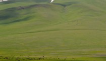
An alluvial fan in the Suusamyr valley.

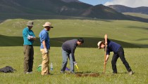
Sampling terrace surfaces

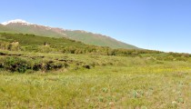
The western 1992 surface ruptures.

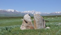
The 1992 surface ruptures in the East

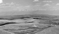
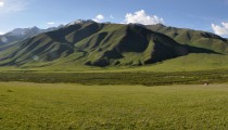
Faulting, folding, uplifted terraces, erosion and wind gaps in the Suusamyr valley.

Huge landslides happened during the 1992 earthquake.

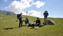
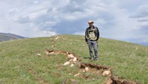
Taking aerial imagery with a drone

Our field camp

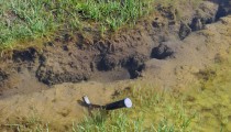
Secondary surface ruptures.

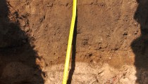
Cleaning the trench wall.

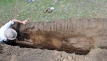
We dug a 10 m long trench by hand…

Not an earthquake effect

Digging sample pits

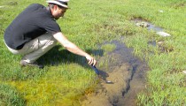
Mud eruption on a landslide…

A hammer for scale, please!

Preparing the DGPS for offset measurements.
A big thank you to our field crew, the great drivers and our cook!
The EwF Project is co-funded by NERC and ESRC. Read the EwF blog and follow the EwF Project on Twitter! Also check out the Twitter accounts of the Earth Sciences Departments in Cambridge and Oxford!
This research was conducted within the framework of COMET, the Centre for Observation and Modelling of Earthquakes, Volcanoes, and Tectonics, funded by NERC.
Further reading
-
Mellors, R. J., Vernon, F. L., Pavlis, G. L., Abers, G. A., Hamburger, M. W., Ghose, S., & Iliasov, B. (1997). The Ms= 7.3 1992 Suusamyr, Kyrgyzstan, earthquake: 1. Constraints on fault geometry and source parameters based on aftershocks and body-wave modeling. Bulletin of the Seismological Society of America, 87(1), 11-22.
-
Ghose, S., Mellors, R. J., Korjenkov, A. M., Hamburger, M. W., Pavlis, T. L., Pavlis, G. L., … & Muraliev, A. R. (1997). The MS= 7.3 1992 Suusamyr, Kyrgyzstan, earthquake in the Tien Shan: 2. Aftershock focal mechanisms and surface deformation. Bulletin of the Seismological Society of America, 87(1), 23-38.
-
Bourdeau, C., & Havenith, H. B. (2008). Site effects modelling applied to the slope affected by the Suusamyr earthquake (Kyrgyzstan, 1992). Engineering Geology, 97(3), 126-145.
-
- Preparing the DGPS for offset measurements.
-
- A hammer for scale, please!
-
- Mud eruption on a landslide…
-
- Cleaning the trench wall.
-

- We dug a 10 m long trench by hand…
-
- Not an earthquake effect
-
- Digging sample pits
-
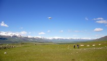
- Taking aerial imagery with a drone
-
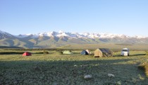
- Our field camp
-
- Secondary surface ruptures.
-
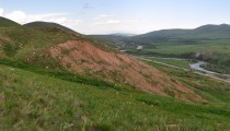
- A huge landslide that occurred during the 1992 earthquake
-
- The 1992 surface ruptures in the East
-
- An alluvial fan in the Suusamyr valley.


No Comments
No comments yet.