The first part of my report on the field work that I did in Kazakhstan this year focussed on the stuff we had done in the South. Here is part II which is all about the Dzhungarian Fault. You’ve never heard about this fault? That’s easily possible. There are only very few papers that deal with this fault. In the 1960s Soviet geologist V.S. Voytovich published results from extensive field work on this fault (Voytovich, 1965; 1969). 40-50 years later a few studies on geodesy and geodynamics covered the broader study area and Shen et al. (2003) did some work in the Chinese part of the fault, but it took until 2013 before Campbell et al. revisited the Kazakh side and came up with new field data. They focussed on the tectonic geomorphology of this structure and determined a slip rate. Given this little amount of research done one would assume that the fault is not very large and of minor importance, but the opposite is true. The fault is around 300 km long in its Kazakh section and probably twice as long in total!

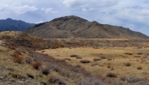
The Dzhungarian Fault in East Kazakhstan
It’s a right-lateral strike slip fault with a large thrust component, it’s clearly active (slip rate probably more than 2 mm/yr), and it forms the Dzhungarian Gate, basically the only gateway between China and Central Asia. This gate is known as part of the ancient Silk Road and it probably played a major role in human and animal migration.
All this is enough reason to have a closer look, to continue Campbell et al.’s work, and to find out what role the Dzhungarian Fault plays in the tectonics of Central Asia. More precisely, we wanted to find out if the fault slip rate changes along strike, when the last earthquakes did happen, and how strong earthquakes can get.
We therefore investigated sites where geological markers were offset by the fault – alluvial fans, terrace risers, streams, and ridges. Then we measured the displacement by DGPS. In some places we also used the helium balloon to collect aerial imagery, which allows us to produce a high-resolution digital elevation model (DEM) of the study site.
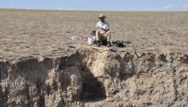
We dug pits in terraces and alluvial fans to find out when they have been abandoned. Organic material for 14C dating was rather rare, so often we had to sample rocks that were covered by carbonate crusts. These crusts form when soil formation starts, so they give us an idea on when the alluvial fan or the river terrace became stable, i.e., inactive. We will date the carbonate rinds with U-Th series. In the northwestern part of the fault we found enough fine-grained material for OSL dating.

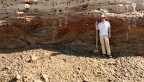
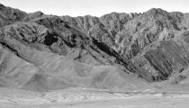
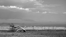
The fault close to Usharal.
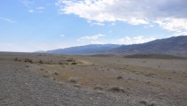
The first few days were spent on reconnaissance, which included loooong drives on rather bad roads parallel to the mountain range. We needed to find suitable study sites and promising targets.

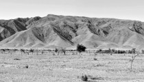
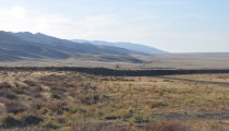
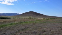
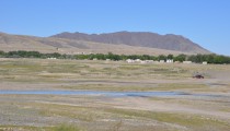
Close to Usharal, the mountain front is a bit smoother and the morphological expression of the fault is less obvious than in the centre where the fault scarps were fresh.

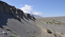
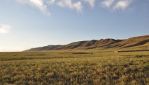
Beautiful strike-slip morphology.

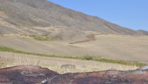
These alluvial fans were offset by the fault right-laterally.

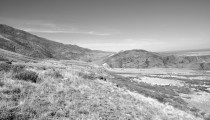
Where rivers cross the fault, we started the hunt for deformed terraces.

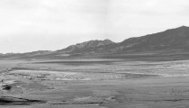
Some of these rivers are quite large and left huge alluvial fans. Today they incise in their modern channels.

No field work was possible here. The sign says: Get off our tank shooting range. Now.
We spent the following days digging pits, sampling terraces and alluvial fans, walking the DGPS and the balloon, and trying to avoid encounters with bears and spiders.

By loading the video, you agree to YouTube's privacy policy.
Learn more
By loading the video, you agree to YouTube's privacy policy.
Learn more

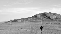
Austin with the DGPS. We often shared the field work like this: I dug sampling pits with the help of our Kazakh and Kyrgyz colleagues, while he recorded km-long DGPS profiles, encountering bear poo, scorpions and the most ugly spiders you can imagine.

Huuuuge spiders. Really huge.

Our mascott, a friendly mantis.

We dug about ten sampling pits like this.

Yeah, radiocarbon dating material!

Austin wrapping OSL samples.

River gravels overlain by fluvial loess overlain by aeolian loess. Austin for scale.

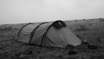
One of our camp sites.
Most of the time we were quite lucky with the weather, which can be miserable in September. However, there were rainy days as well and we survived one storm that brought my tent close to collapse.

We had a serious storm which almost killed my tent.

After the rain.

After the rain the mist raises from the mountain front.
By loading the video, you agree to YouTube's privacy policy.
Learn more
When the rain was gone, we continued the field work.

These risers are offset both vertically and horizontally.

Photo taken from a push-up ridge.

The same push-up ridge with the fault scarp.

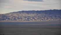
The fault scarp is visible for more than 30 km.

These fans are also affected by the faulting…

One of my favourite sites – offset ridges.

There were few petroglyphs only.

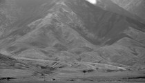
The SE part of the Dzhungarian Fault close to Druzhba.

The opposite site of the Dzhungarian Gate in China.

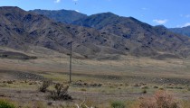
Austin and the fault.

Wild wild east.

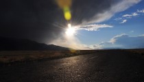
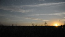
The steppe has the most beautiful sunsets.

Moon rise. Yeah, right, MOON rise.
We were funded by COMET and the Earthquakes without Frontiers project (EwF). Both are on Twitter (@NERC_COMET, @EwFProject), have great websites, and EwF also has a nice blog!
You might also like to follow Earth Sciences Cambridge (@EarthSciCam) and Oxford (@OxUniEarthSci).
References and further reading:
-
Campbell, G. E., Walker, R. T., Abdrakhmatov, K., Schwenninger, J. L., Jackson, J., Elliott, J. R., & Copley, A. (2013). The Dzhungarian fault: Late Quaternary tectonics and slip rate of a major right‐lateral strike‐slip fault in the northern Tien Shan region. Journal of Geophysical Research: Solid Earth, 118(10), 5681-5698.
- Shen, J., Y.-P. Wang, Y.-Z. Li, H. Jiang, and Z.-Y. Xiang (2003), Late Quaternary Right-Lateral Strike-Slip Faulting Along The Bolokenu-Aqikekuduke Fault In Chinese Tian Shan, Seismol. Geol., 25(2), 183–194.
-
Voytovich, V. S. (1965). Development of Dzhungar deep fault. International Geology Review, 7(5), 874-883.
- Voitovich, V. S. (1969), Nature of the Dzungarian deep fault (in Russian), Tr. Geol. Inst., 183, 189.
-
- River gravels overlain by fluvial loess overlain by aeolian loess. Austin for scale.
-
- We had a serious storm which almost killed my tent.
-

- Huuuuge spiders. Really huge.
-

- One of our camp sites.
-
- Austin wrapping OSL samples.
-
- After the rain.
-
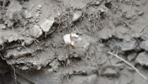
- Yeah, radiocarbon dating material!
-
- These risers are offset both vertically and horizontally.
-
- Photo taken from a ppush-up ridge.
-
- These alluvial fans were offset by the fault right-laterally.
-
- Beautiful strike-slip morphology.
-
- The fault close to Usharal.
-

- Austin with the DGPS. We shared often shared the field work like this: I dug some sampling pits with the help of our Kazakh and Kyrgyz colleagues, while he recorded km-long DGPS profiles, encountering bear poo, scorpions and the most ugly spiders you can imagine.
-
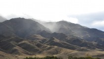
- After the rain the mist raises from the mountain front.
-

- Our mascott, a friendly mantis.
-
- Moon rise. Yeah, right, MOON rise.
-
- The fault scarp is visible for more than 30 km.
-
- These fans are also affected by the faulting…
-
- There were few petroglyphs only.
-
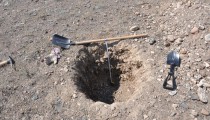
- We dug about ten sampling pits like this.
-
- Wild wild east.
-

- Photo taken from a push-up ridge at the Dzhungarian Fault.
-
- The same push-up ridge with the fault scarp.
-
- The SE part of the Dzhungarian Fault close to Drushba.
-
- The opposite site of the Dzhungarian Gate in China.
-
- Where rivers cross the fault, we started the hunt for deformed terraces.
-
- Soem of these rivers are quite large and left huge alluvial fans. Today they incise in their modern channels.
-
- One of my favourite sites – offset ridges.
-
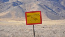
- No field work was possible here. The sign says: Get off our tank shooting range. Now.
-
- Close to Usharal, the mountain front is a bit smoother and the morphological expression of the fault is less obvious than in the centre where the fault scarps were fresh.
-

- The steppe has the most beautiful sunsets.
-
- Austin and the fault.
-
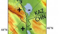
- The Dzhungarian Fault in East Kazakhstan


No Comments
No comments yet.